
Solar Impulse Calculator
The Solar Impulse Calculator computes distances and travel times between locations (latitudes and longitudes) on the globe and provides relevant data on the Solar Impulse mission during it's critical flight across the Pacific. The goal is to provide useful and timely information to the media and others interested in the Solar Impulse mission based upon simple calculations.
Description
The Solar Impulse voyage is attempting to cross the Pacific from Nagoya airport on the island of Honshu, Japan. From Japan, the solar powered aircraft is flying to Hawaii. This will be the first completely solar powered flight across the Pacific ocean in a heavier than air (e.g. air plane) vehicle.
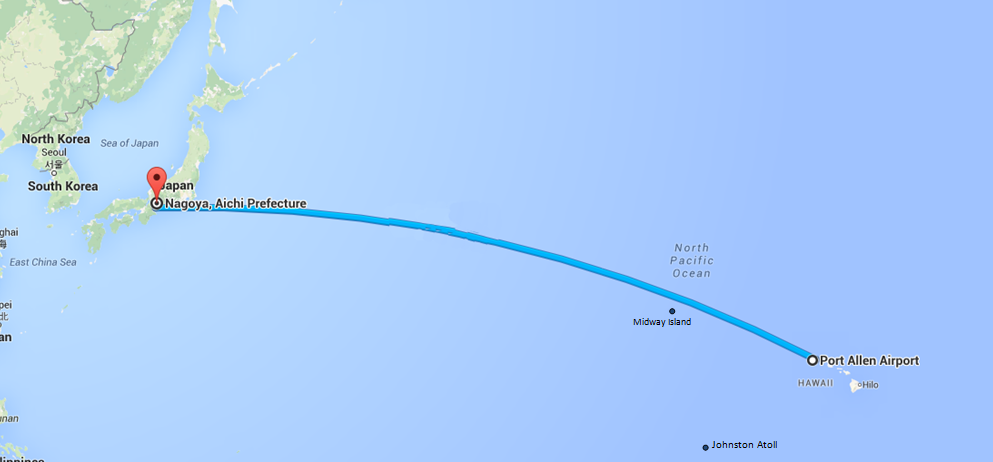 Great circle arc from Nagoya, Japan to Hawaii
Relevant Data
Velocity (Speed)
The Solar Impulse aircraft cruises at a speed of 70 kilometers per hour (43 mph). However, ground speed is usually different than air speed. Based on the wind speed and its direction, the ground speed is greatly effected, going faster with a tailwind and slower with a headwind. See the Ground Speed equation for detail
Position (Location)
The table below lists the latitude and longitude for airports in Hawaii, Midway Island and Johnston Atoll. The formulas in this calculator provide an estimate of the distances between points (latitudes and longitudes) and the time to travel between them.
Location Table
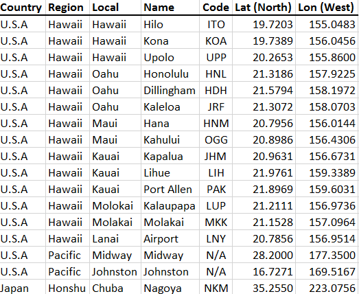
These airports include the main airports listed in Hawaii if the flight is a success, the home port of Nagoya in case the craft has to turn back, and the abandoned airfields at Midway Island and Johnston Atoll in case of an emergency.
See Also
Equations and Data Items
- Comments
- Attachments
- Stats
No comments |